FRF

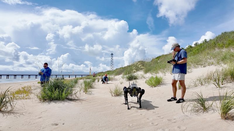
#36: SandHound: Applying robotics to advance critical coastline survey capabilities

For several sweltering weeks along the North Carolina coastline, an ERDC teampushed a quadruped robot with a suite of advanced sensors to its limit to test its abilityto conduct critical beach landscape surveys. The research – known as the SandHound Project – is working to validate whether thequadruped can operate at all levels of the…

Read More

#29: Underkeel Clearance: Quantifying demand for USACE dredging

The ships calling upon U.S. ports have grown larger, and navigation channels must be dredged to greater depths to handle them. However, dredging is expensive, and the U.S. Army Corps of Engineers (USACE) needs more data-driven tools to prioritize limited resources more efficiently. Responding to this need, ERDC developed Underkeel Clearance. Applying newly available ship…

Read More

#25: CorpsCam: Enabling more proactive coastal management through real-time monitoring and data

Monitoring large and constantly changing coastlines can be expensive, time consuming and dangerous. Traditional surveying methods are also limited because they only provide a single snapshot in time and don’t capture the full picture. As a result, coastal managers don’t always have the information they need to understand dynamic coastal conditions and plan projects that…

Read More