innovation

Video: #41: Antarctic Expertise

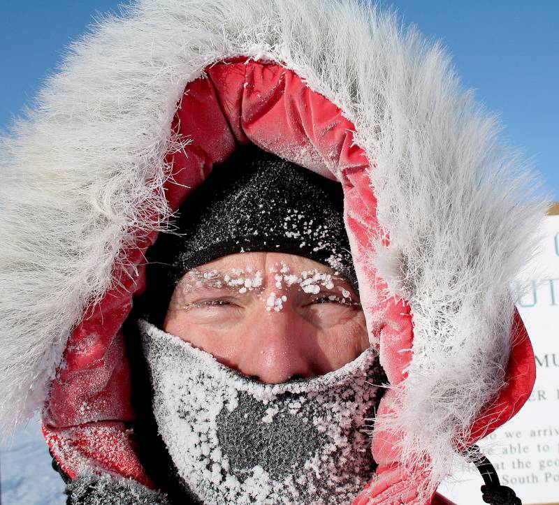
https://www.youtube.com/watch?v=DfCGuTVytBo George Blaisdell’s career is one for the record books. His contributions to engineering in one of the world’s most inhospitable environments are legendary, but for a man with more than 30 trips to Antarctica, the work is far from over. Today’s guest is Blaisdell, a research civil engineer with ERDC’s Cold Regions Research and…

Read More

#41: Antarctic Expertise: ‘Explorer’ has helped shape, advance cold regions engineering

George Blaisdell’s career is one for the record books. His contributions to engineering in one of the world’s most inhospitable environments are legendary, but for a man with more than 30 trips to Antarctica, the work is far from over. Today’s guest is Blaisdell, a research civil engineer with ERDC’s Cold Regions Research and Engineering…

Read More

#39: Global Forest Modeling Toolkit: Mission-critical intelligence about vegetation around the world

Forests cover nearly a third of the Earth’s land surface and present multiple challenges to military forces. Dense trees restrict mobility, limit surveillance, impede air support and degrade communication. But not all forests are the same. To best counter these difficulties, leaders need detailed information about vegetation attributes, such as canopy cover, stem diameter and…

Read More

Podcast Resources: #39: Global Forest Modeling Toolkit

ERDC’s Forest Ecosystems Dynamics team developed the Global Forest Modeling Toolkit, which applies artificial intelligence and high-performance computing to provide detailed vegetation attributes of forests around the world. Listen to the podcast with ERDC’s Dr. Nathan Beane: PowerofERDCpodcast.org/39-global-forest-modeling Watch a video of the podcast: PowerofERDCpodcast.org/39-global-forest-modeling_video For inquiries about ERDC’s Global Forest Modeling Toolkit, email ERDCinfo@usace.army.mil During…

Read More

Video: #39: Global Forest Modeling Toolkit

https://www.youtube.com/watch?v=9lzrnJcOFwQ Forests cover nearly a third of the Earth’s land surface and present multiple challenges to military forces. Dense trees restrict mobility, limit surveillance, impede air support and degrade communication. But not all forests are the same. To best counter these difficulties, leaders need detailed information about vegetation attributes, such as canopy cover, stem diameter…

Read More

#39: Global Forest Modeling Toolkit: Mission-critical intelligence about vegetation around the world

Forests cover nearly a third of the Earth’s land surface and present multiple challenges to military forces. Dense trees restrict mobility, limit surveillance, impede air support and degrade communication. But not all forests are the same. To best counter these difficulties, leaders need detailed information about vegetation attributes, such as canopy cover, stem diameter and…

Read More

#36: SandHound: Applying robotics to advance critical coastline survey capabilities

For several sweltering weeks along the North Carolina coastline, an ERDC teampushed a quadruped robot with a suite of advanced sensors to its limit to test its abilityto conduct critical beach landscape surveys. The research – known as the SandHound Project – is working to validate whether thequadruped can operate at all levels of the…

Read More

#20: Operational Energy

Military operations require large amounts of energy to train, move and sustain forces, as well as to power weapons platforms – and this is known as operational energy. Given the high human toll and financial cost of supplying this energy to frontline forces, new strategies are seeking to electrify the battlefield and reduce the reliance…

Read More