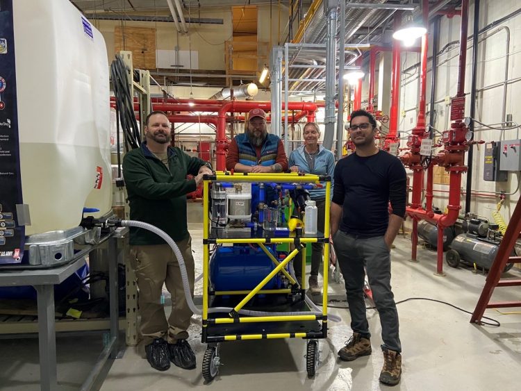
unmanned aerial vehicle

#21: Enhanced Terrain Processing

Soldiers are often forced to operate using outdated geospatial data that may not accurately represent current ground conditions. This creates challenges when trying to find the best possible routes for troop maneuvers or when selecting helicopter landing zones. The U.S. Army Engineer Research and Development Center (ERDC) is developing a series of tools to solve…

Read More

#5: Ice adhesion basic research

The rapid accumulation of ice creates significant challenges for U.S. military operations and civilian activities in cold environments. It hampers mobility, disrupts communication, creates power outages and degrades infrastructure. That’s why a team of ERDC researchers is conducting innovative basic research to unravel the physical processes of how ice attaches to different surfaces, paving the…

Read More