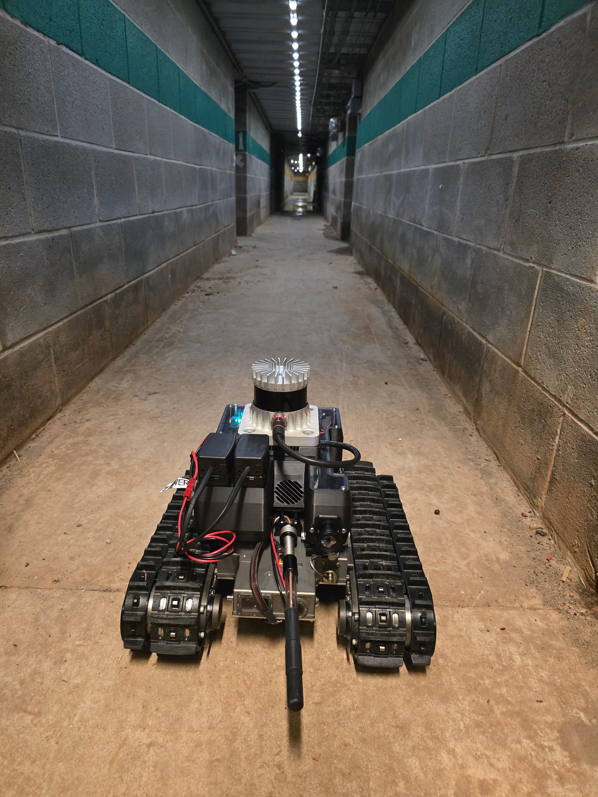
A low-cost unmanned ground vehicle capable of producing 3D maps, the Muddy robot has solved a variety of mapping challenges since 2017.
Developed by the U.S. Army Engineer Research and Development Center (ERDC), Muddy is often used to test more expansive robotic platforms and to enable other projects. Its combination of autonomous navigation, affordability and flexibility makes it an ideal system to validate new technologies and to operate in dangerous, extreme or difficult to access environments – giving Warfighters superior situational awareness of the battlespace and a platform that can support missions across any domain.
We discuss Muddy with Dr. Garry Glaspell, a research chemist at ERDC’s Geospatial Research Laboratory who has worked with the robot since its first days.
We talk about Muddy’s creation and maturation (4:06), its capabilities (12:42) and the programs it has supported (15:04). We also discuss how Muddy got its name (24:52), the lessons learned from various field tests (33:14) and what modifications are on the wish list (36:29).
For more information on the Power of ERDC podcast, visit https://www.PowerofERDCPodcast.org.
Podcast: Play in new window | Download


Recent Comments